

Maps per Book
Most historical maps fix a moment. The House of Holland series cannot afford that. Between Gerulf's first holding on the Frisian coast and the death of Floris V in 1296, the country itself changes shape. The coastline retreats and advances. Peat bogs drain into fields. The Zuiderzee opens where there was once solid ground. Land that carries a familiar Dutch place-name did not exist in 950.
This section contains three kinds of maps. The Growing County map traces the shifting coastline and expanding comital territory across four centuries, from the first Gerulfings to the height of Floris V's power. The thematic maps make single arguments that prose cannot easily carry: the gap between legal territory and real power, the overlap of secular and ecclesiastical authority, the slow creation of land from water. The per-book maps accompany each novel individually, charting the journeys and the places that belong to each volume's plot. Treat them as a companion to the novels and as a historical resource in their own right. Every marker on every map links back to the relevant book page or background article.
The Maps of Book I: Frisia in the Age of the Danes, c. 885
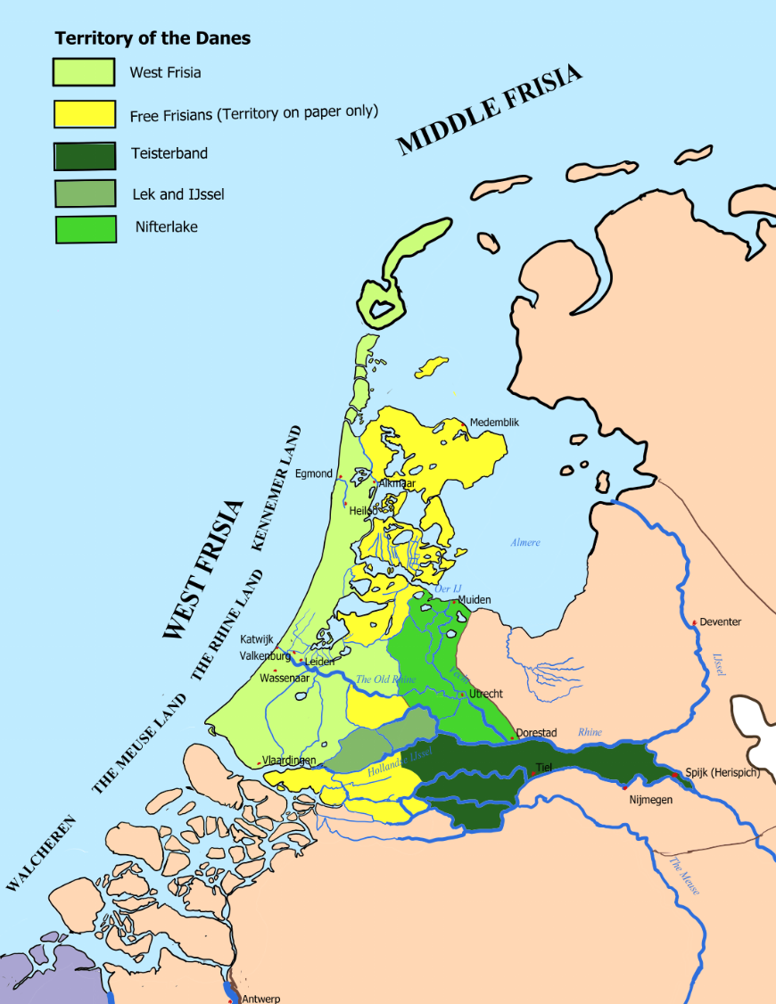
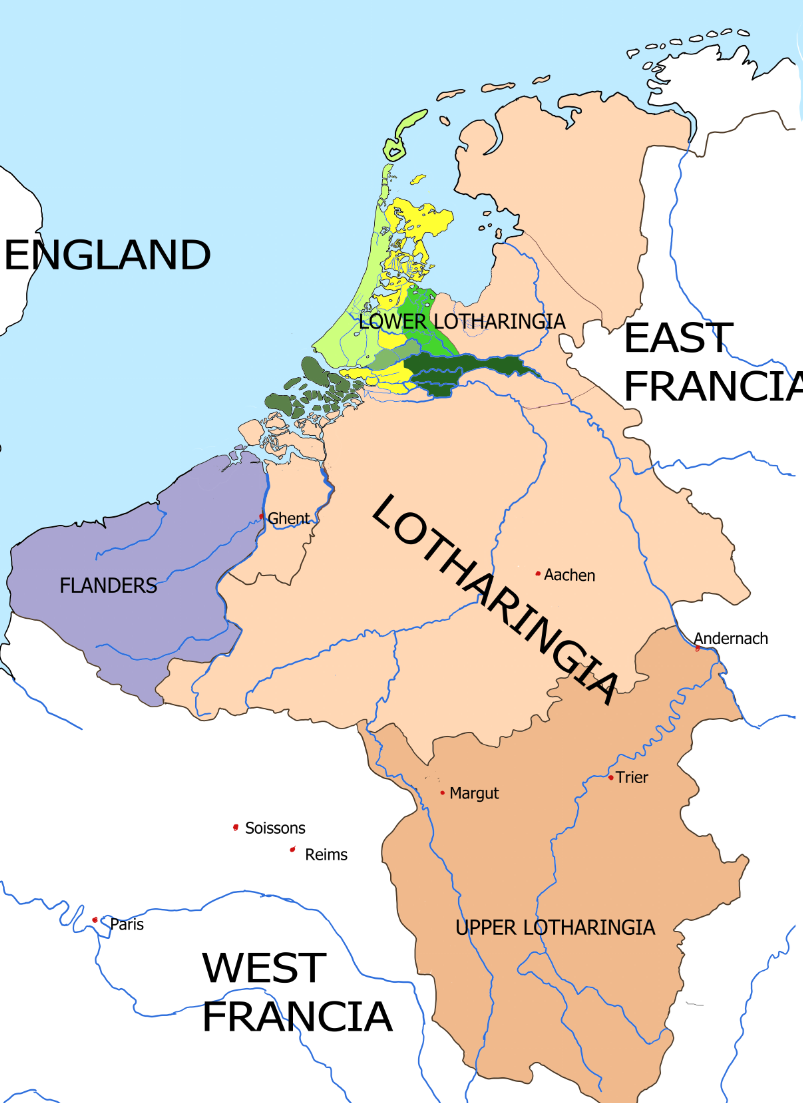
This is the world of Book I, and it is not the Netherlands. Ninth-century Frisia was a far longer coastal strip of salt marsh, creek, peat and dune, where the line between land and water shifted twice a day. There were no dykes; people lived on mounds raised by hand above the reach of the flood.
The shaded districts are the fief of Godfrid the Dane: West Frisia along the coast, Nifterlake on the Vecht, Lek and IJssel, and Teisterbant with Tiel at its heart. Frankish emperors granted such land to Danish leaders in the hope of making the wolf a shepherd. Almost exactly these districts would be held, within a generation, by Gerulf's son Waldger.
Read the rivers as roads, not as borders. Here lay the mouths by which the Northmen sailed into the heart of the empire, and no king was ever strong enough to close that door. Four points carry the story: Egmond, Gerulf's mound on a poor coast; Herispich — later Spijk — where Godfrid was lured to an assembly in 885 and killed; Tiel, his stronghold and his registers; and Deventer, where the bishop of Utrecht kept his seat while Utrecht itself lay half abandoned.
The Maps of Book II: Frisia after the Dane, c. 890–899
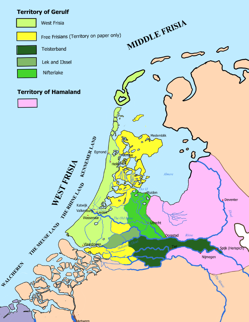
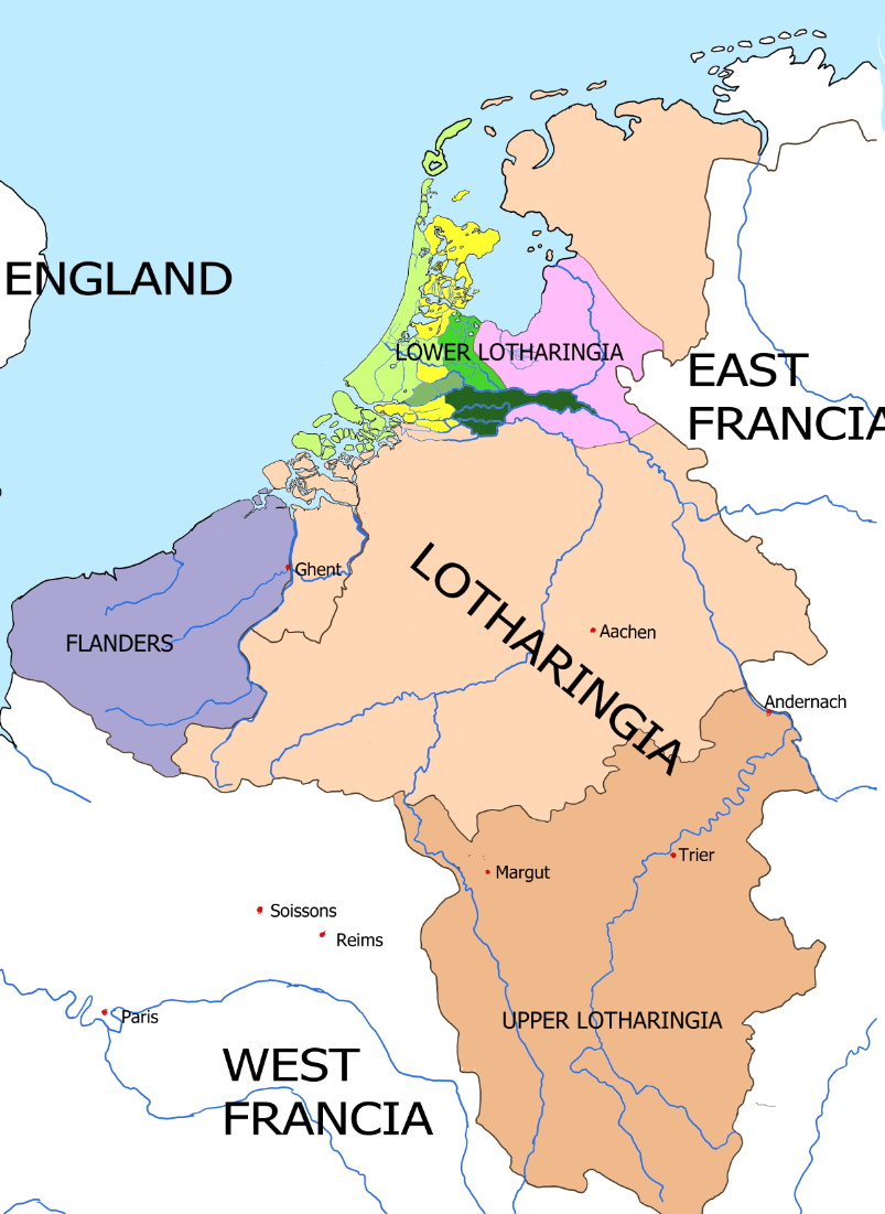
One line of the legend has changed, and it carries the whole story. What was the fief of a Danish king is now the territory of Gerulf: the coast, the Vecht, Lek and IJssel, and Teisterbant on the great rivers.
It does not stay whole. At Gerulf's death the green divides between his sons. Waldger takes the rich river districts, with the rising toll town of Tiel as the crown jewel; Dirk keeps West Frisia — the wet, poor coastal strip of Kennemerland. It is the finest irony of this history that the poorest portion proved the most lasting. Waldger's branch died out within a few generations and his river lands fell piece by piece to king and church. The line that endured was the youngest son's, on the worst ground.
The pink is new. Hamaland is the country of Everhard Saxo — Saxon count, styled margrave of Frisia, builder of ring-forts, and once Gerulf's fellow conspirator against Godfrid. It straddles the IJssel, presses hard against Waldger's border and encloses Utrecht and Dorestad.
The Map of Book III: West Frisia, c. 900–923
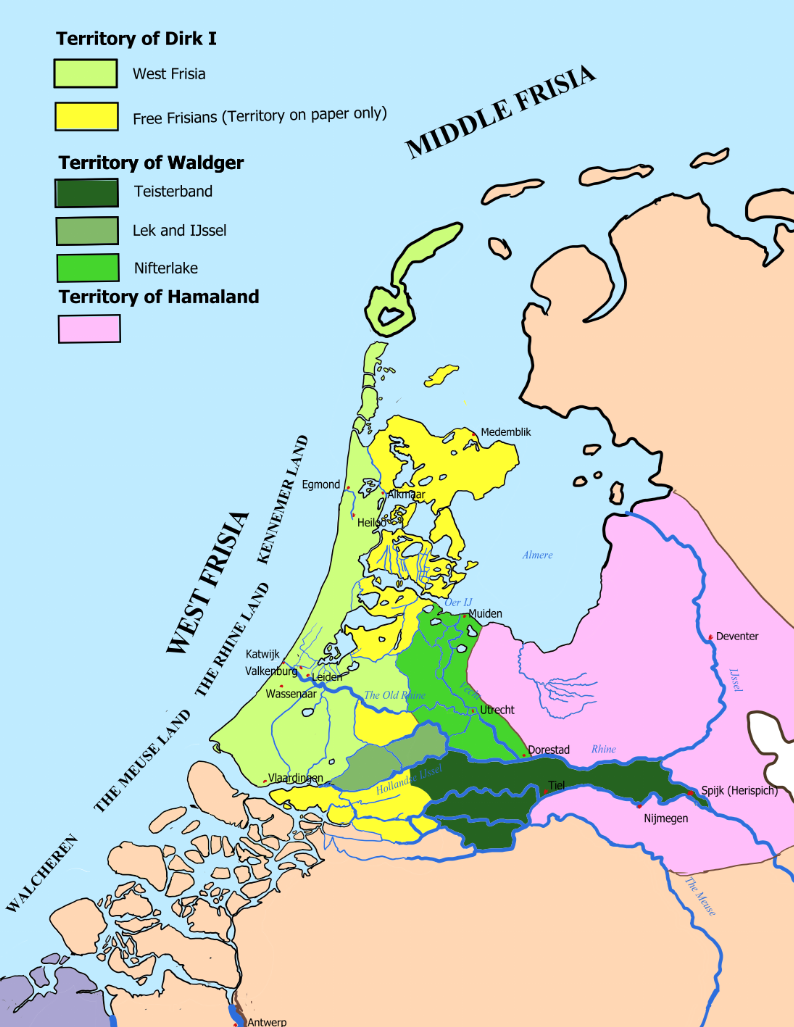
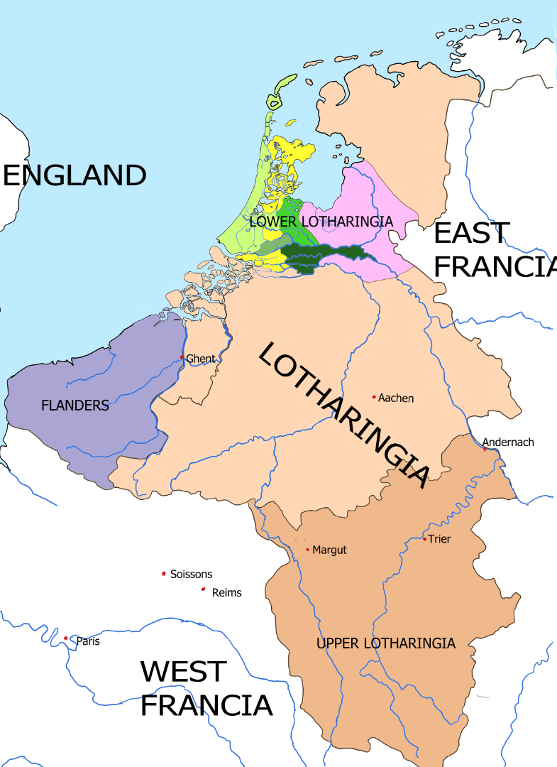
Two things on this map are new, and both are the story.
The first is the yellow. Dirk's parchment names him count of the whole coast, set down by a king all the way to the furthest terp in the north — but the yellow is territory on paper only. Beyond Alkmaar the land breaks apart into lakes, marsh and distant terps, and there live Frisians who will know no count: they pay him nothing and keep their own right, old and hard as the ground. Alkmaar is the edge. No man holds all that stands on his parchment.
The second is that the green is no longer one colour. The rich river districts are his brother Waldger's now, and beyond them lies the pink of Hamaland, where a dead man stands between the houses — Everhard Saxo, killed by Waldger in 898. In this book that debt is settled with a bride.
Then read the small names along the coastal strip: Alkmaar, Katwijk, Valkenburg, Leiden, Naaldwijk, Vlaardingen. These are Dirk's posts — a rampart at the mouth of the Meuse, a watchtower on the Old Rhine — set down one by one in a poor, empty land. Post by post, he is giving it a skeleton.
The Map of Book IV: West Frisia, 939–948
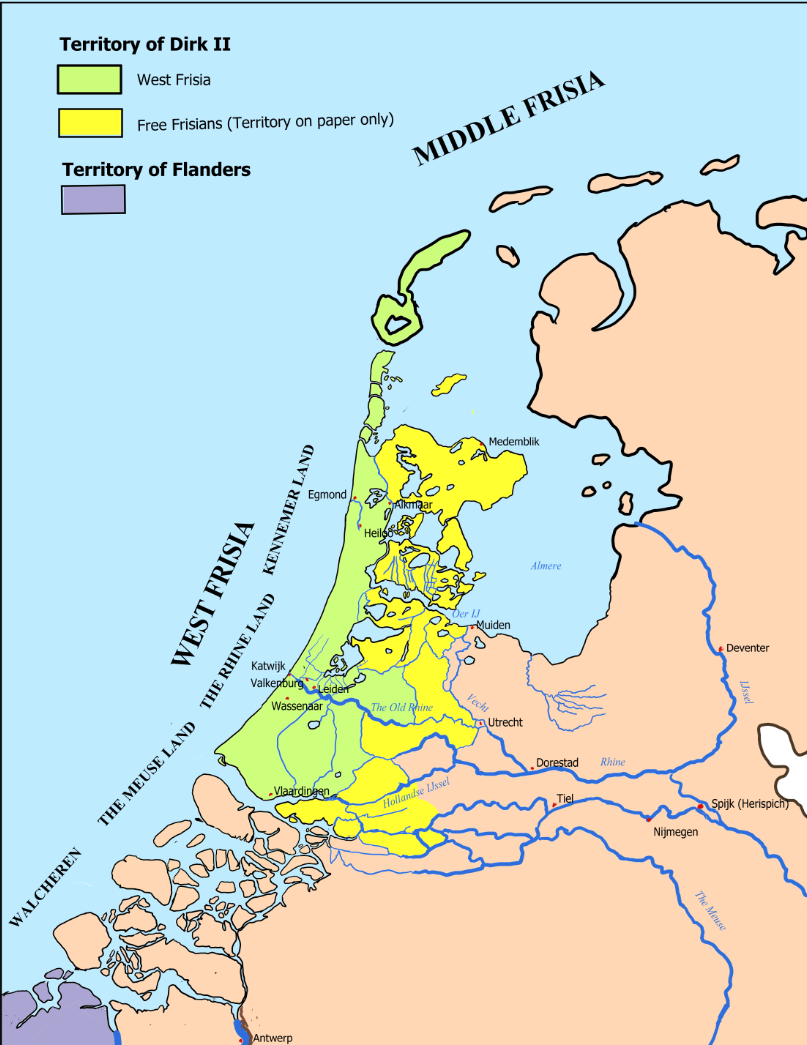
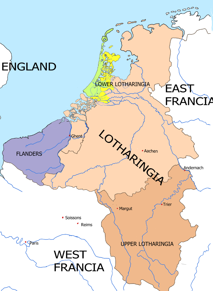
Set this map beside the one for Book III and what strikes you is what has gone.
The river districts are no longer coloured at all. In 939 the rich branch of the house — Waldger's line, with Teisterbant, Tiel and the toll rights at Muiden — chose the losing side in the Lotharingian revolt, and after the battle at Andernach it vanishes from history in a single season. The monastery at Tiel passed to the bishop of Utrecht. Hamaland has gone with it. What is left of Gerulf's inheritance is a coast, and the theme of the whole series is written in that absence: the sword robs, but does not build.
And half of what remains is yellow. Beyond Alkmaar the count's word simply ceases to hold — not through any war, but through something stiller and more humiliating: a border at which authority evaporates. Texel, Den Burg and Medemblik lie inside a title and outside a grip. So read the green as the entire county: a ribbon of dune, creek and peat from Alkmaar down to the Meuse. It is from here that Dirk II went south to marry a great-great-great-great-granddaughter of Charlemagne.
The Map of Book V: West Frisia, c. 950–977
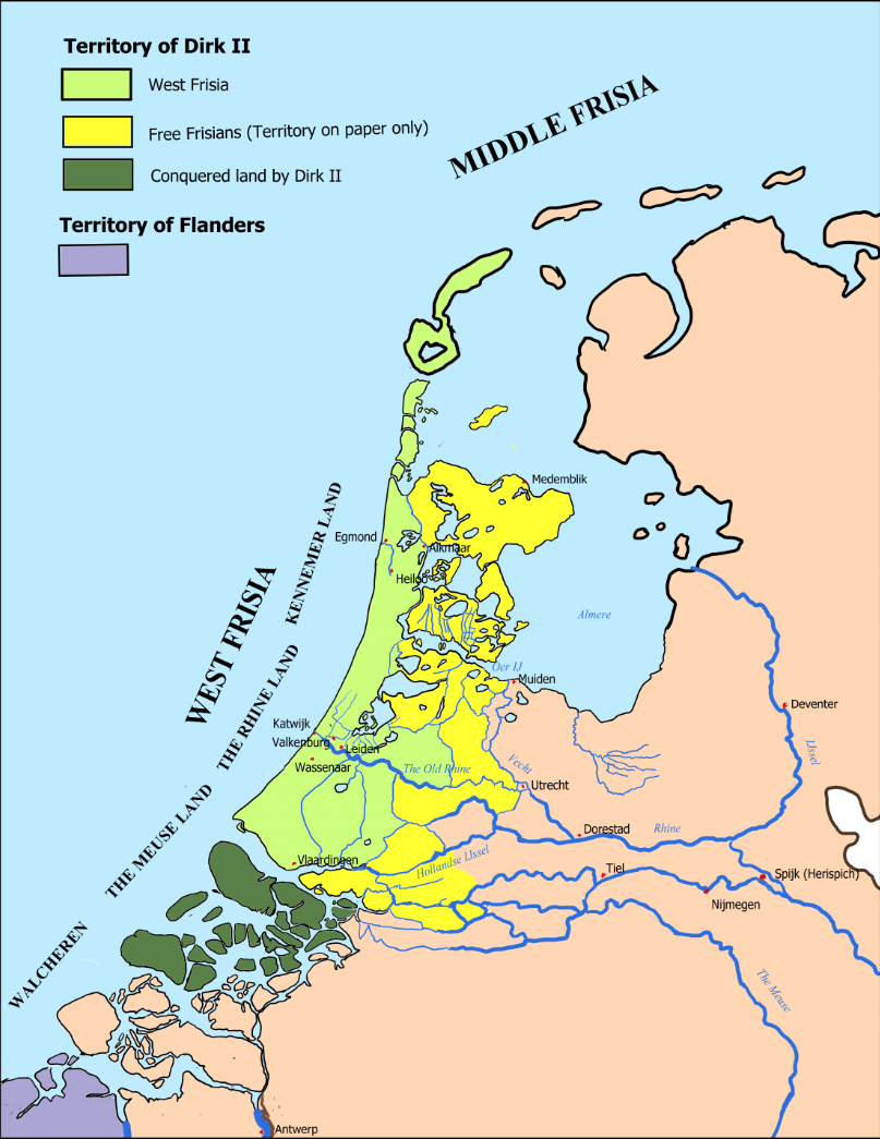
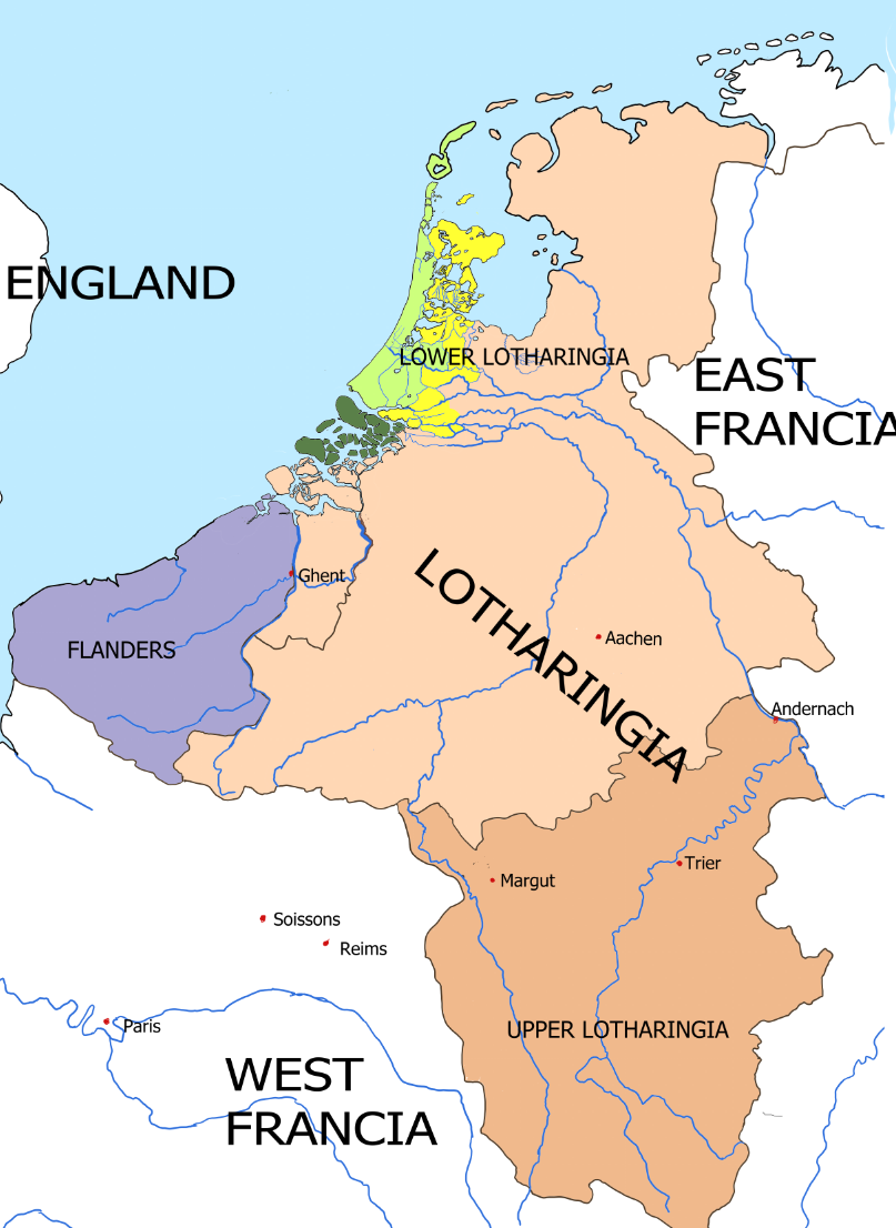
New on this map is the purple in the south-west: Flanders, the house of Dirk II's wife. Hildegard's marriage brought this coast a pedigree reaching back to Charlemagne — and with it entanglement, the grasp at Ghent, and a lifetime spent between Flemish, French and imperial interests.
Now look at the water between. A hundred miles of open sea separate the count's north from his Flemish south, and that emptiness is the weakness his enemies use: a house that can bleed in two places at once. In 969 Dirk goes into the Zeeland islands — not by pitched battle but by tide and channel, with skippers who know the water from birth. Schouwen is the link that matters, with its old ring fort at Burgh. Then he stops, at Zonnemaire, and takes not one island more: a border, he says, is not where your strength stops winning but where it stops being able to hold.
The green itself scarcely alters. What grows is Egmond, where a small foundation becomes a rich abbey and a saint is raised onto a golden altar — and with it the long quarrel with Utrecht, in whose diocese Egmond lay.
The Map of Book VI: West Frisia, 977–993
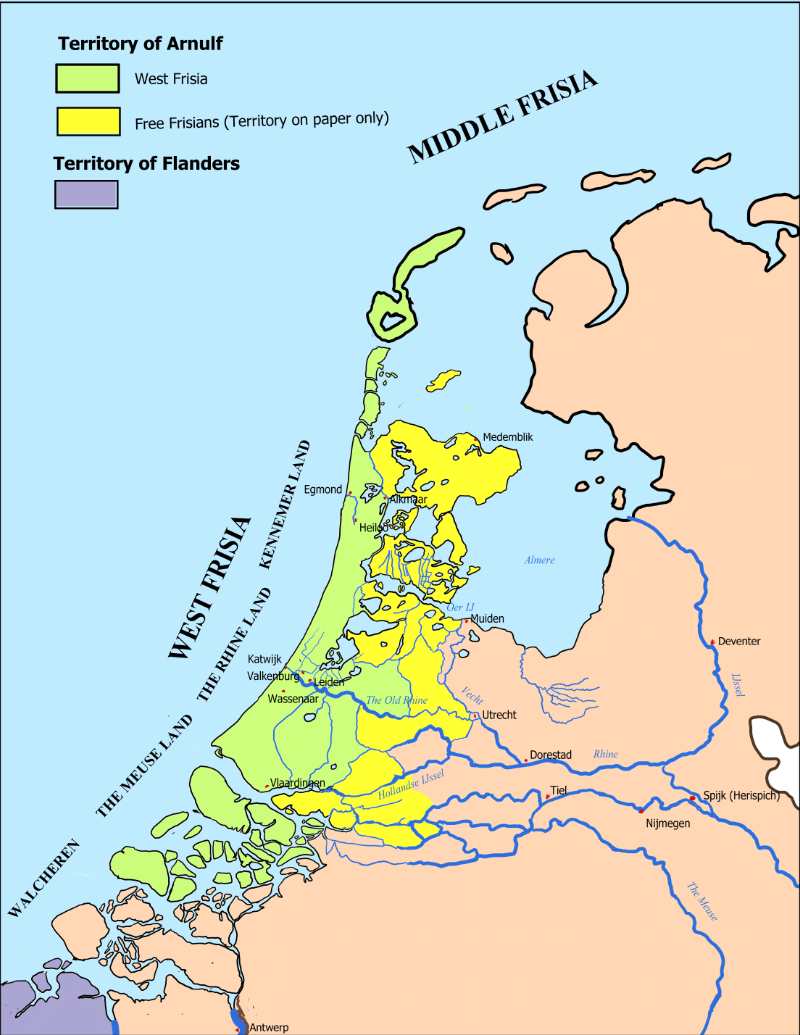
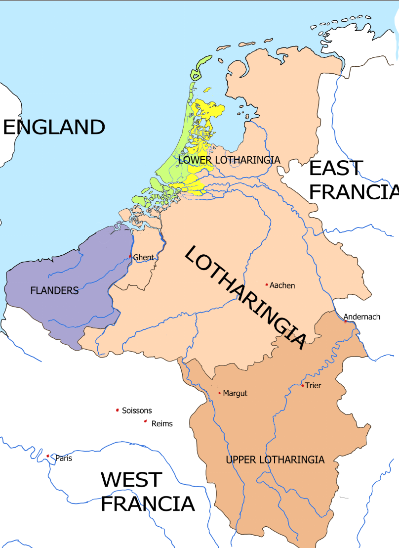
The purple in the south-west is where Arnulf came from, not what he ruled. He was born in Flanders and grew up there; "of Ghent" is a birthplace, not a title. What he inherited is the narrow green ribbon along the coast.
Its true size can be measured. When the emperor mustered his horsemen in 983, West Frisia owed twelve — where other territories sent forty, or a hundred. The yellow to the north is what it has been for three generations: a title without a grip.
But the quarrel that killed him was not in the yellow. Later tradition placed Arnulf's death at Winkel in the far north, complete with a miracle of sweet water welling up at his prayer. That story was written some two hundred and fifty years later, for counts who needed an ancient Frisian enmity. The oldest sources say only that he fell in the autumn of 993, fighting his own subjects, somewhere in newly reclaimed ground — along the Old Rhine, or near the mouth of the Meuse.
The Map of Book VII: West Frisia, 993–1006
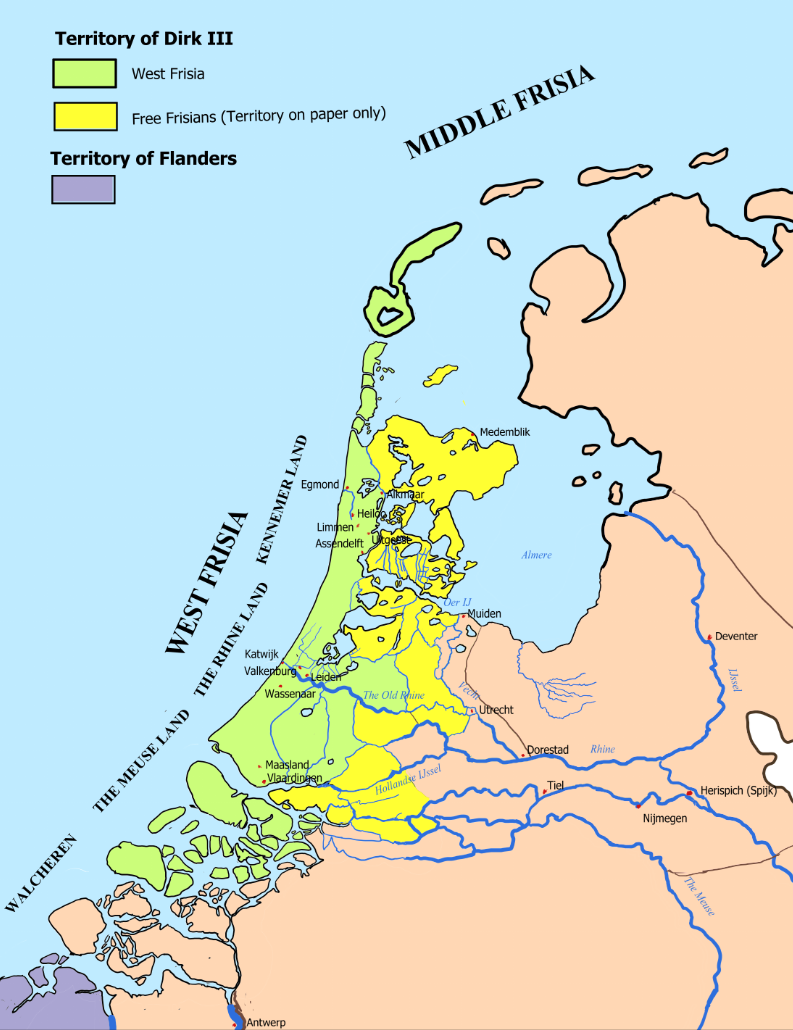
The green has not grown much. That is the point.
When Arnulf died in 993, the county he left to his eleven-year-old son was still the same narrow territory along the coast and river mouths. On a map, almost nothing had changed. In reality, everything had. Dirk III was a child, his mother Liutgard governed for him, and much of what held the county together depended not on borders drawn on parchment, but on who controlled its halls, roads, waterways and local officials.
The important movement in this book is south. In 985 Dirk's grandfather had received lands around the Merwede, in the wet country where the great rivers reached the sea. Under Liutgard and the young Dirk, Vlaardingen becomes increasingly important. The river is not merely a boundary: it is a road. Ships moving between the North Sea and the Rhine have to pass through these waters, and whoever controls the banks can begin to control the traffic.
By 1006 the map still shows a small county. But it is no longer quite the county Arnulf left behind. Its centre of gravity is moving towards the river mouths, and Dirk has begun to understand something that will define the next part of his life: he does not need to command the whole river. He only needs to stand where everyone has to pass.
The Map of Book VIII: West Frisia, 1006–1018
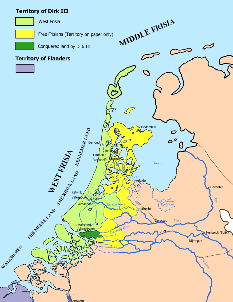
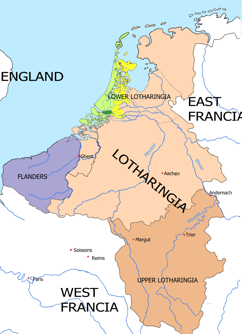
The green has begun to spread. But the real change is happening on the water.
By 1006 Dirk III is no longer the boy whose inheritance had to be protected by his mother. He rules in his own name, and the county he controls reaches far beyond the old heartland around Egmond. To the south lie the lands around the great river mouths — low, wet country where the Rhine, Maas and Merwede divide and change course before reaching the North Sea.
This is where the story of The Battle of the Bog is fought. Vlaardingen has become the centre of Dirk's power in the south. The rivers are the great roads of north-western Europe, carrying merchants between the Rhineland, Tiel, England and the North Sea.
Dirk does not control those roads from end to end. He controls something more useful: the narrow reaches through which ships must pass. There he can demand payment, offer protection and turn geography into power.
The wider map shows why this matters. Dirk's county is still small beside Flanders, Lotharingia and the lands of the Empire. Utrecht possesses ancient claims to much of the region, while Tiel's merchants depend upon an open route to the sea. What looks like a remote strip of marshland is therefore sitting across one of the most important commercial routes in the region.
By 1018 those competing claims can no longer coexist. An imperial army comes west to restore an authority that exists clearly on parchment but far less clearly on the ground. At Vlaardingen it enters a landscape of rivers, creeks, reeds, peat and narrow banks — a landscape Dirk and his men know intimately.
The maps explain what happens next. Dirk does not need to be more powerful than the Empire. He only needs the Empire to fight him where the map is on his side.
Thematic Maps
These maps make arguments that prose cannot. Each one draws out a tension or a structural condition that runs beneath the novels: the gap between legal territory and real power, the overlap of secular and ecclesiastical authority, the act of creating new land from old water. They are documents before they are illustrations.
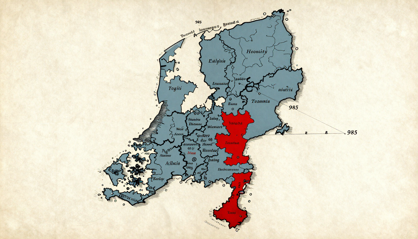
The Two Counties
Book VI turns on a single gap: the county on parchment and the county in fact. The territory granted to Arnulf in proprium in 985 is far larger than the narrow botting district — the coastal strip that actually paid. Lay one over the other and you see the entire tragedy in one image. Read Book VI.
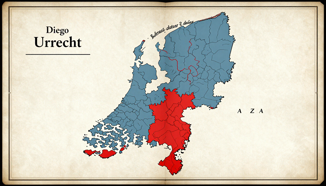
Count and Bishop on One Map
The central conflict of the early volumes is not military — it is jurisdictional. The diocese of Utrecht sits almost exactly over the county of Holland. Two powers, one map. This is literally the map Bishop Baldwin studies in Chapter 18 of Book VI. Read the background.
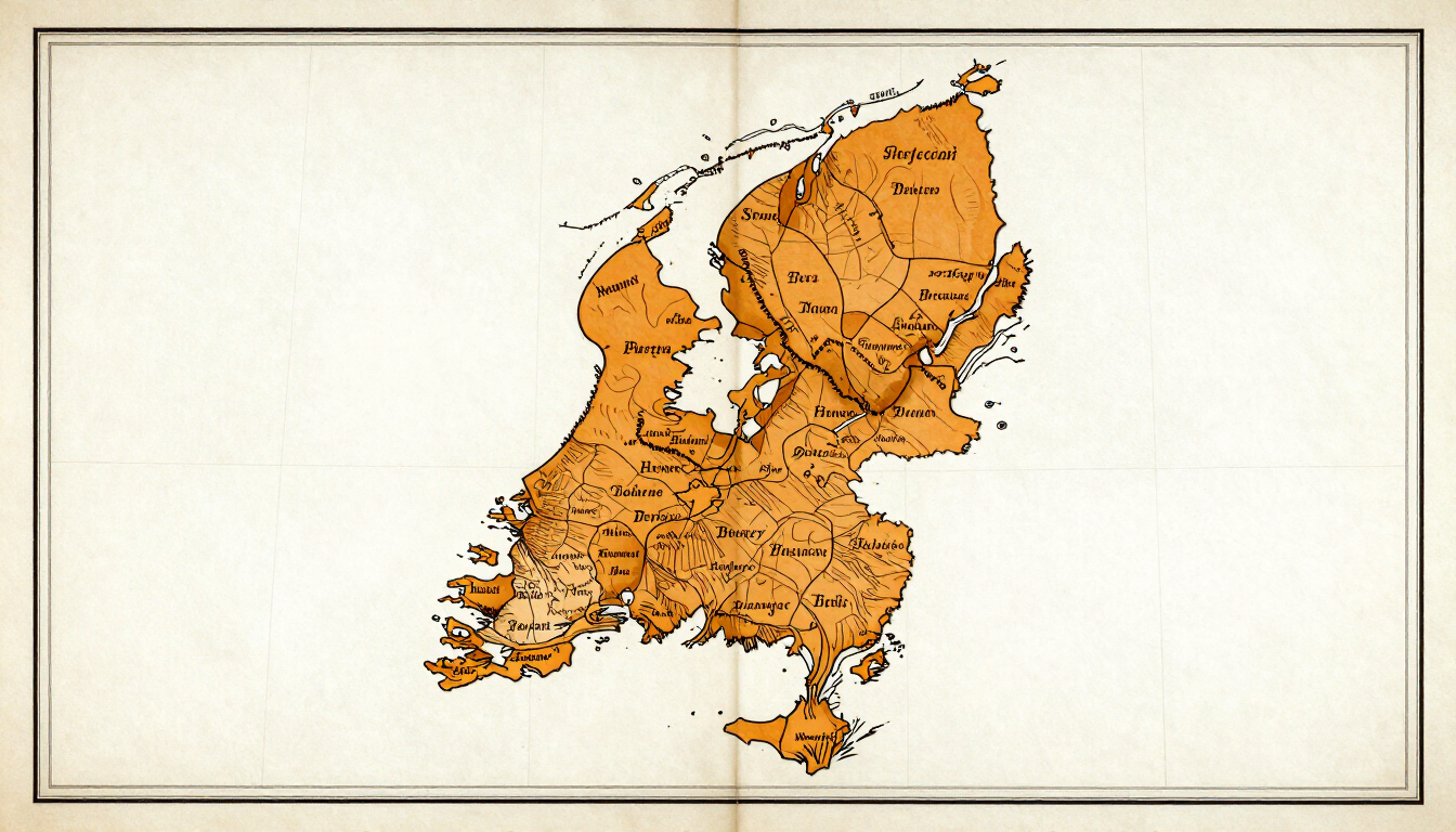
The Land That Did Not Exist Yet
Modern Holland is largely made ground. The fields your characters drain and stake in the novels carry place names that a Dutch reader recognises — but those fields were not there yet. This map shows what was dug into existence between roughly 950 and 1150. Read the background.
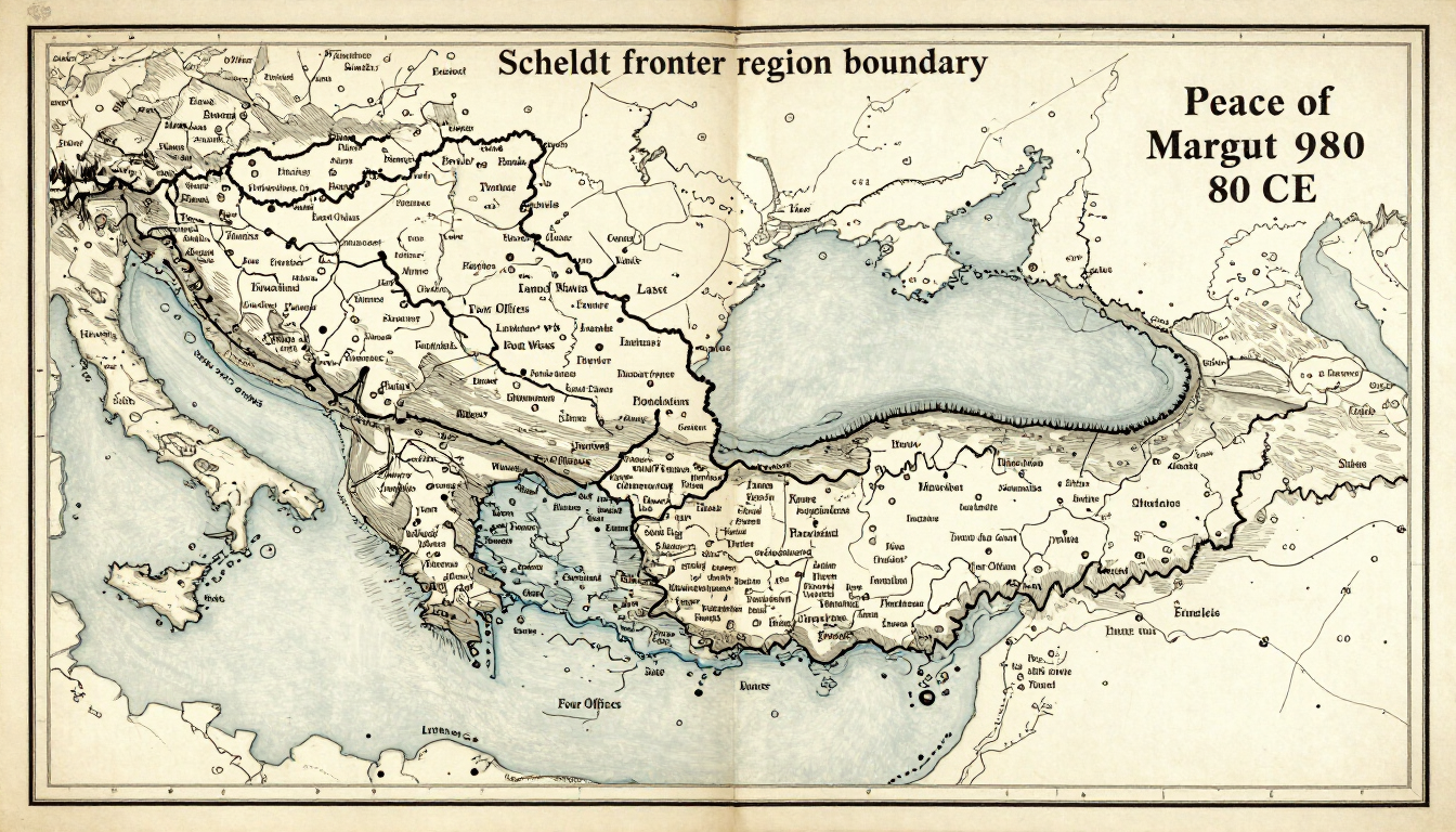
Two Empires and a Border
The County of Holland sits on a fault line between two empires. The Scheldt marks a boundary that Lotharingia, the Four Offices, and the peace of Margut in 980 all attempt to settle. This map holds the political geography that is otherwise very hard to keep in your head while reading. Read the background.
Maps by Volume
Each volume in the series carries its own map — a journey map for plots that travel (Book VI traces a route from the Frisian coast through Ghent, Trier, the Ardennes, and south to Calabria), a detail map of the county for plots that stay home. These maps are commissioned once and serve two purposes: they appear here as a navigational aid for readers, and they appear in the front matter of the printed editions.
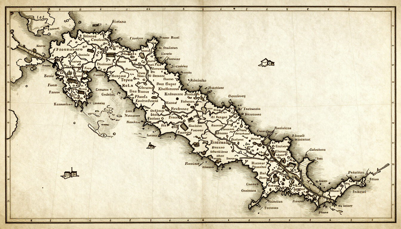
Book I — The First Gerulfings
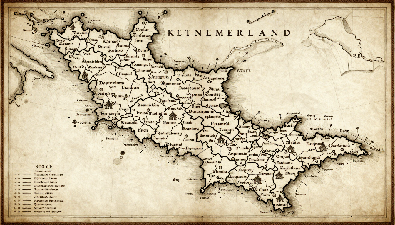
Book II — The Coast Holds
Book III — The Long Shore
Book IV — Dirk II
Book V — The Contested Border
Book VI — Arnulf's Road
Book I — The First Gerulfings
New maps are published with each volume. All maps use the same cartographic style — medieval place names with modern names in brackets on first use — so the series builds a consistent geographical language across all twenty planned volumes.